


This article is part of The Making of Bengal, a long-form historical series by The Bengal. Earlier chapters traced the Mahasthan Brahmi inscription, Bengal’s connection to Ashoka’s empire, and the practical economic reasons the Mauryas valued the region. This chapter draws those threads together by looking at the physical cities themselves, the fortified towns that turned Bengal’s river valleys and delta plains into a genuinely urbanised landscape for the first time.
A Later, but Distinct, Urban Revolution
India’s so-called second urbanisation, the wave of city-building that followed the much earlier and geographically distant Indus Valley Civilisation, is usually associated with the Middle Ganga plains, where cities like Pataliputra, Vaishali and Rajgir had already taken shape by the sixth century BCE. Bengal’s own version of this process arrived later. Archaeologists studying the region describe the dawn of the early historic period in the Lower Ganga-Brahmaputra valley, spanning present-day West Bengal, Bangladesh and parts of Assam, as considerably more obscure and delayed than in the middle Gangetic plains, beginning at least three hundred years after that process was already well underway further west, and coinciding rather closely with the rise and eastward extension of Mauryan rule.
This delay makes sense given everything explored earlier in this series. Bengal’s first farming villages, the Chalcolithic Pandu culture of the Ajay and Damodar valleys, were themselves a relatively gradual development, and it took time for scattered village life to accumulate into anything resembling a true town. Researchers tracing this transition have identified clusters of Chalcolithic and Northern Black Polished Ware overlap sites concentrated in Birbhum, Bankura and Burdwan districts, precisely the districts where cities like Mahasthangarh and Bangarh would eventually rise under early Mauryan influence.
The City Behind a Goddess’s Name
Among Bengal’s earliest confirmed cities, few have a richer or more tangled naming history than Bangarh, the site in Gangarampur, on the banks of the Punarbhaba river in present-day Dakshin Dinajpur district. Bangarh represents the ancient and medieval city known to inscriptions as Kotivarsha, and its identity has accumulated an unusually large number of alternate names over the centuries, Devikota, Umavana, Banapura and Sonitapura among them, according to the eleventh century lexicographer Hemachandra.
Archaeological excavation, first carried out by Kunja Gobinda Goswami of Calcutta University between 1938 and 1941, and followed up by the Archaeological Survey of India in 2007 and 2009, has revealed a fortified citadel enclosed by extensive mud ramparts covering close to 25 hectares. The excavated sequence shows the city passing through eight distinct cultural phases stretching from around 500 BCE through to the period of Muslim rule in Bengal, encompassing the pre-Mauryan, Mauryan, Shunga, Kushana, Gupta, post-Gupta and Pala periods. Based on archaeological finds, Kotivarsha appears to have first become a significant town around the Shunga period, having begun, in the Mauryan phase before it, as a considerably more modest settlement protected by a simple earthen rampart.
By the Gupta period, a set of inscribed copper plates known as the Damodarpur inscriptions confirm that Kotivarsha functioned as an administrative vishaya, a district-level unit, governed by an official called a vishayapati, appointed by a provincial governor and forming part of the wider administrative division of Pundravardhana Bhukti, the same Pundravardhana territory named in the Mahasthan inscription discussed earlier in this series. The city continued to hold real significance well into the medieval period, later becoming a centre of Tantric Shaivism, and figuring in Buddhist and Vaishnavite literature as a place of pilgrimage, before its eventual conquest under Bakhtiyar Khilji, whose successors made it, under the name Devkot, the first Muslim administrative capital in Bengal.
A Recurring Urban Blueprint
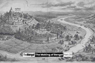
What is striking about Bangarh is how closely its basic layout echoes what archaeologists have found at other early Bengal cities. Scholars studying Bengal’s early historic architecture note a pattern repeated across the region’s urban centres, at Mahasthangarh in Bogra district, at Bangarh in Dinajpur district, at Chandraketugarh in 24 Parganas district, at Mangalkot in Burdwan district, and at Pokharna and Dihar. Each of these sites shows traces of mud ramparts, and researchers have suggested that an early Bengal city typically contained something like an acropolis, a fortified core at the settlement’s heart, distinct from the wider habitation area around it.
This shared blueprint, a defended citadel surrounded by a broader settlement, suggests that Bengal’s earliest urban planners, whoever they were, were working from a broadly consistent model of what a city needed to be: defensible at its core, but extensive enough at its margins to support trade, agriculture and a growing population. It is the same basic logic already seen at Wari-Bateshwar, discussed in an earlier chapter of this series, whose own planned road and fortified enclosure fit comfortably within this wider regional pattern.
Mangalkot and the River Towns of the West
Further evidence of this network comes from Mangalkot, on the right bank of the Kunur river near its confluence with the Ajay, in the Katwa subdivision of Burdwan district. Excavated by the Department of Archaeology at Calcutta University between 1986 and 1990, the site’s material record shows that from the Mauryan period onward, Mangalkot grew into what researchers describe as a full-fledged urban centre. Its later Gupta-period levels produced terracotta artefacts that, while not always matching the finest examples of Gupta craftsmanship elsewhere, still display many of the characteristic qualities of that artistic tradition, before the settlement continued through a long post-Gupta and medieval occupation.
Mangalkot’s location, at a river confluence within the same broader Ajay-Damodar river system that had earlier supported the Chalcolithic Pandu culture villages explored in an earlier chapter of this series, is telling. It suggests a direct, traceable line of development: the same river valleys that once hosted small Copper Age farming villages growing rice and working copper eventually gave rise to genuine urban centres once wider political integration, first under the Mauryas and later under successive regional powers, created the conditions for towns to expand and endure.
A Network, Not a Collection of Isolated Towns
Perhaps the most important insight from recent scholarship is that Bengal’s first cities should not be understood as isolated, disconnected dots on a map. Researchers studying settlement patterns across the region have proposed thinking in terms of a regional rural network, radiating outward from major nodal urban centres. Bangarh and Mahasthangarh, in particular, have been identified as landmark anchors within a wider zonal complex covering the Varendra region of northern Bengal, around which a supporting network of villages, farmland and smaller settlements needs to be visualised in order to understand how the whole system actually functioned.
This helps explain how a single Mauryan administrative order, like the one preserved in the Mahasthan Brahmi inscription, could function at all. A famine relief decree issued to a mahamatra at Pundranagara was not simply managing one isolated town. It was managing a node within an interconnected system of dependent villages, agricultural hinterland and secondary settlements, all linked by the same rivers that had built the delta itself and would go on to carry trade, tribute and administration between Bengal’s rising cities for centuries to come.
From Village Mounds to Urban Landmarks
Seen together, Mahasthangarh, Bangarh, Chandraketugarh, Mangalkot and Wari-Bateshwar tell a coherent story. Bengal’s urbanisation did not happen all at once, nor did it arrive as an import forced onto a passive countryside. It grew, gradually and unevenly, out of the same farming villages and river valleys already explored in earlier chapters of this series, accelerated significantly once Mauryan administrative structures reached the delta, and then continued to evolve, city by city, across the Shunga, Kushana, Gupta and Pala periods that followed. Bengal’s first cities were not simply built. They were, in the truest sense, grown.
In the next chapter of this series, we turn to what has been called Bengal’s lost capital of antiquity, examining the archaeological evidence for the region’s earliest known ruling seats and what they reveal about political authority in the centuries before Bengal’s first independent kingdoms.
Sources: Banglapedia, “Kotivarsa,” “Mangalkot2” and “Architecture”; Wikipedia, “Bangarh”; IndianNetzone, “Archaeological Sites of West Bengal”; Government of West Bengal, District Dakshin Dinajpur, “Bangar Excavation Site, Gangarampur”; t2ONLINE, “Whispers of the Past: 7 Unexplored Historical Sites in West Bengal”; IJARIIE, “Re-Exploring Devkot: The First Muslim Capital of Bengal”; Nupur Dasgupta, “Settlements in Ancient Bengal: Some Observations,” Anthropology Bangladesh.