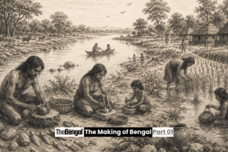

This article is part of The Making of Bengal, a long-form historical series by The Bengal. In the previous chapter, we traced the deep geological forces, continental drift and mountain building, that set the stage for Bengal’s formation. Now we follow the story down to ground level, to the two rivers that did the actual work of building the land.
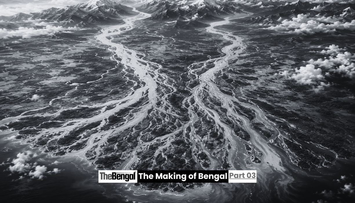
If the Himalayas provided the raw material, the Ganges and Brahmaputra were the builders. Everything that later generations would call Bengal, its farmland, its forests, its trade routes and its cities, exists because these two rivers spent an almost unimaginable stretch of time moving mountains, quite literally, from north to south.
Two Rivers, Two Very Different Journeys
The Ganges and the Brahmaputra do not begin their journeys anywhere near each other, and for most of their length they behave like entirely separate systems with entirely separate personalities.
The Ganges rises on the southern side of the Himalayas, in the mountains of northern India, and flows broadly southeast across the Indo-Gangetic plain, gathering strength from a wide network of tributaries as it moves through some of the most densely populated land on the planet. The Brahmaputra takes an almost opposite path. It originates on the Tibetan plateau, north of the Himalayan range, and initially flows east for hundreds of kilometres before executing one of the most dramatic bends of any river in the world, turning sharply south and then west to cut through the eastern Himalayas and enter the plains of Assam.
Only in the final stage of their journeys, deep in the heart of the Bengal delta, do these two very different rivers finally meet, joining with a third river, the Meghna, before emptying together into the Bay of Bengal. It is a strange kind of partnership. Two rivers that spent thousands of kilometres travelling apart, shaped by different mountains and different climates, arrive at the same destination and combine their efforts to build a single shared landscape.
The Mechanics of Building Land
What makes the Ganges and Brahmaputra so consequential is not simply that they carry water. It is what they carry along with it.
As these rivers cross the Himalayas and the surrounding highlands, they pick up enormous quantities of eroded rock, sand, silt and clay, material scraped from mountains that are, geologically speaking, still actively rising. By the time this sediment-laden water reaches the lowlands, the rivers are transporting a genuinely staggering volume of material. Together with the Meghna, they deliver more than one billion tonnes of sediment into the Bay of Bengal every year, drawn from a combined watershed of roughly 1.75 million square kilometres stretching across India, Nepal, Bhutan, China and Bangladesh.
That sediment does not simply vanish into the ocean. As the rivers slow down on the flat, low-lying plains near the coast, they lose the energy needed to keep carrying their load, and the material they have been transporting for hundreds of kilometres begins to settle out. Layer by layer, flood by flood, this constant deposition has built up the land that now forms Bangladesh and West Bengal. In places, the accumulated sediment beneath the delta exceeds twenty kilometres in thickness, one of the largest such accumulations found anywhere on Earth, a record of just how much of the Himalayas has been dismantled and reassembled downstream.
The result is the Ganges-Brahmaputra delta, sometimes simply called the Bengal delta, spanning an estimated 105,000 square kilometres and holding the title of the largest river delta on the planet.
Rivers That Refuse to Sit Still
One of the more striking features of both the Ganges and the Brahmaputra is how little either river has respected the idea of a fixed course.
Over the long span of the delta’s construction, the Ganges built and then abandoned several earlier deltas before settling into something close to its current position, shifting eastward over time as tectonic movements in western India gradually redirected its flow. The Brahmaputra was, if anything, even more dramatic in its wandering. Historical surveys from earlier centuries recorded the river flowing on a course much further east, passing near present-day Mymensingh, before it eventually shifted onto a straighter, more southward path closer to its current channel, a change linked to tectonic uplift in the Shillong Plateau region.
This tendency to shift, known to geologists as avulsion, is not a flaw in the system. It is essentially how a delta grows. When a river’s channel becomes clogged with its own sediment, or when tectonic movement tilts the land slightly, the water finds a new, lower path and abandons the old one, spreading fresh sediment across a different part of the plain. Repeated many times over millions of years, this process is what allowed the delta to expand outward across such a vast area rather than simply piling sediment in one narrow strip.
For the rivers, this restlessness never really stopped. It continued into the more recent past that written history can actually document, and it continues today, a fact that has shaped, and periodically upended, human life in the region for as long as people have lived there.
Ice Ages, Sea Levels and a Hidden Canyon
The rivers were not building in isolation. Global climate cycles played their own part in shaping the delta, particularly through their effect on sea level.
During the depths of past ice ages, enormous volumes of the planet’s water were locked away in glaciers, and sea levels around the world dropped dramatically, by more than a hundred metres at their lowest point. With the coastline pushed far out into what is now the Bay of Bengal, the Ganges and its tributaries carved a deep canyon into the exposed seabed as they raced to reach the retreating shoreline. When the ice age ended and the glaciers melted, sea levels rose again, drowning that ancient canyon and flooding the delta plain, forcing the rivers to once again adjust their courses to the new coastline.
That submerged canyon still exists today, known as the Swatch of No Ground, and it continues to function as a channel funnelling sediment from the delta out into the deep waters of the Bay of Bengal, where it eventually settles to form the Bengal Fan, the largest submarine sediment fan on Earth. It is a reminder that the story of these rivers extends well beyond the visible land, continuing quietly beneath the waves.
High Ground in a Restless Land
For the people who would eventually settle this delta, the rivers’ habit of shifting course created a landscape defined by contrast: vast expanses of extremely fertile but flood-prone lowland, interrupted by a handful of slightly elevated, more stable terraces.
These higher terraces, features such as the Barind Tract and the Madhupur Tract, represent older phases of the delta’s construction, ground that was built up earlier and then left behind as the rivers moved on to build elsewhere. Because this land sat above the worst of the seasonal flooding, it offered something the surrounding floodplain could not: relative permanence.
It is no accident that early human settlement in the region gravitated toward exactly this kind of ground. The fortified early city explored in an earlier chapter of this series, along with other early settlements identified across the delta, consistently favoured these flood-free zones, a pattern that reflects a very practical understanding of the landscape’s risks. Long before anyone had mapped the region’s geology, the earliest inhabitants of Bengal had already learned, through direct experience, which parts of the land the rivers were less likely to reclaim.
A Partnership That Never Really Ends
What the Ganges and Brahmaputra accomplished together is not, in any meaningful sense, finished. The same processes that built the delta over tens of millions of years are still active today. Sediment continues to arrive from the Himalayas. The rivers continue to shift, flood and rebuild. Sea levels continue to change, now driven increasingly by modern climate pressures rather than ice age cycles, raising fresh questions about the long-term future of the very land these rivers built.
But the essential story remains the one written across the delta’s soil. Bengal was not simply a location where history happened to occur. It was a landscape actively constructed, grain by grain, flood by flood, by two rivers that carried a mountain range down to the sea and, in doing so, built a place fertile and expansive enough to eventually support one of the most densely settled civilizations in human history.
In the next chapter of this series, we return to the human story that this landscape made possible, following the descendants of Bengal’s earliest settlers as they moved from scattered farming communities toward the first organized towns and cities that the delta’s rivers had unknowingly prepared the ground for.
Sources: Banglapedia entry on the Bengal Delta; The Geological Society of London; ScienceDirect research on the Bengal Depositional System and the evolution of the Ganges-Brahmaputra delta plain; BioOne Journal of Coastal Research studies on the evolution of the Bengal Delta; The Daily Star’s reporting on the geological history and future of the Bengal Delta.